
Streams cross close to 250 kilometers of the surface of Jesus island. Since 2013, CRE de Laval works on the characterization of the main streams in the context of the Urban streams project of Laval.
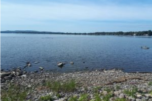
Deux-Montagnes Lake is located on the western side of Jesus Island. This fairly shallow lake (depth varying between 2 to 6 meters) occupies 150 square kilometers. It is also surrounded by the Kanesatake mohawk reserve and the following 18 municipalities:
-
Saint-André-d’Argenteuil
-
Saint-Placide
-
Oka
-
Pointe-Calumet
-
Sainte-Marthe-sur-le-Lac
-
Deux-Montagnes
-
Laval-sur-le-Lac
-
L’île-Bizard-Sainte-Geneviève
-
Senneville
-
Sainte-Anne-de-Bellevue
-
Perrot Island
-
Terrasse-Vaudreuil
-
Vaudreuil-Dorion
-
L’île-Cadieux
-
Vaudreuil-sur-le-Lac
-
Hudson
-
Rigaud
-
Pointe-Fortune
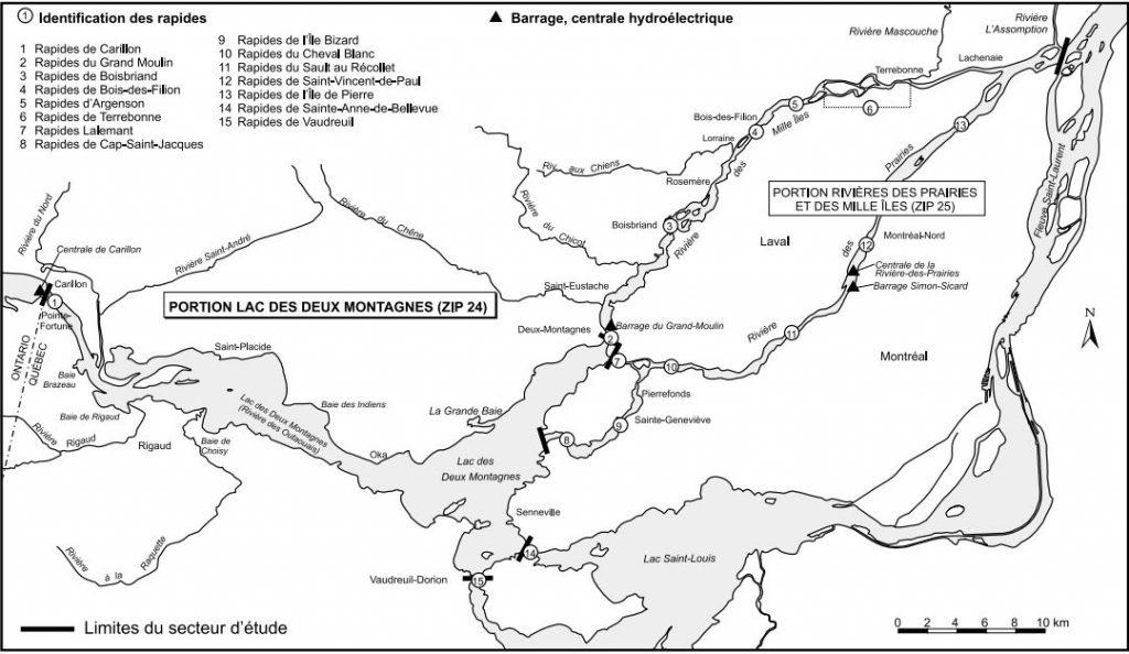
Deux-Montagnes Lake area. Map from Robitaille, J. (1999).
Before the 21st century, the lake ecosystem was under much human-induced pressure. Many pulp and paper mills were settled along the Ottawa River and rejected their effluents that accumulated downstream, into the lake. Wood floating was a common practice (banned in 1994) to transport the logged trees from the boreal forest to Montreal, which also impacted river and lake ecology. Furthermore, twenty percent of the shoreline was artificialized through the building of low walls which reduced wildlife habitat and interfered with the functioning of the lake ecosystem. In addition, agricultural fields on the western part of the lake rejected phosphorus and nitrogen into streams flowing into the lake. The eastern part was more of a place of leisure for Montrealers. Today, the strict regulation has allowed a massive improvement of water quality now classified as ‘’excellent’’.
The proximity to urban centers and the high water quality make Deux-Montagnes Lake an important leisure site where one can swim, observe wildlife, go fishing and enjoy watercraft activities. In fact, several thousands of boats are counted each year on the lake and through the locks of the Carillon dam. There are also 700 000 visitors in Oka National Park every year.
Lake waters
Although the lake is located in the St. Lawrence floodplain region, the lake waters are quite different from the ones flowing in the St. Lawrence River. This is due to the fact that the lake is the receiving area of the Ottawa River, which begins in Abitibi-Témiscamingue rather than the Great Lakes like the rest of the St. Lawrence River. Ottawa River is the receiving area of six different catchments totalizing 146 000 square kilometers, ranging from Ste-Adèle to Rouyn-Noranda and including La Tuque. Once the river reaches the St. Lawrence floodplains, it widens and forms the Deux-Montagnes Lake. The North river also flows into the lake. The map below shows that every single drop of water located in this perimeter ends up flowing in the Ottawa River.
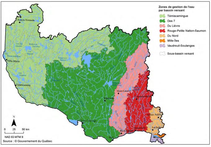
Watershed limits included in Ottawa River’s watershed (Government of Quebec, 2015)
The water flowing in the Deux-Montagnes Lake is sometimes designated as ‘’brown’’ water because it is sourced from the boreal forest. Most of the soils in the boreal forest are classified as podzols and leach humic and fulvic acids into lakes and streams which end up in the Ottawa River. In comparison, the ‘’green’’ waters from the Great Lakes catchment are clearer and less turbid because they are more mineral and are sourced from different and less acidic soils.
However,‘’brown’’ waters are not dangerous for human consumption! In fact, there are two water treatment plants ; one is located in Oka and the other one in Deux-Montagnes. They source their waters from the lake. All municipalities downstream from the lake also source their drinking water indirectly from it. That is the case of Montreal, Pincourt, Pointe-Calumet, Pointe-Claire, Sainte-Anne-de-Bellevue and Sainte-Marthe-sur-le-Lac, which source their water downstream, either in the St. Louis Lake or in the St. Lawrence River. Municipalities such as Laval, Rosemère or Terrebonne source their drinking water in the Mille-Îles River, also downstream of the Deux-Montagnes Lake. In short, more than one million people depend on these lake waters.
Because so many people depend on the Deux-Montagnes Lake, CRE de Laval collaborated with other organizations in order to promote the idea of making Deux-Montagnes Lake a sanctuary for clean water to ensure the perpetual protection of this water resource for generations to come.
You may read about the open letter published in LaPresse+ (in French).
The great value of Deux-Montagnes Lake is not solely defined by its waters, but also by its ecological richness
This lake is a great natural ecosystem that has survived numerous anthropological pressures through time.
It is home to 62 islands that have remained untouched due to their geographical isolation. Their shorelines are natural and they hold many native forests ecosystems such as maple-hickory or basswood stands, silver maple swamps, rush and cattail marshes and other areas dominated by rich aquatic vegetation such as water-lilies and northern water-milfoil.
All these diverse ecosystems intertwine and create an ideal environment for wildlife (as well as wildlife observers and fishermen!). Deux-Montagnes Lake supports crucial nesting and feeding grounds for birds but also for spawning fish. Walleye, bass, sturgeons and perch swim around all year long.
Deux-Montagnes Lake is also the sole spawning area for the American shad in the St. Lawrence area. This anadromous fish (meaning it is born in freshwaters but lives in saltwaters, just like salmon), was initially commercially fished throughout the region. Combined to the building of dams (Carillon plant, Grand-Moulin dam and the Prairies plant) to control water levels, it all led to an important population decrease. The American shad is now considered to be vulnerable according to provincial regulations. There is now only one way up to their spawning area; from the St. Lawrence River, they reach St. Louis Lake, cross the Vaudreuil channel and reach the Deux-Montagnes Lake. The out-migration occurs during the summer and both juveniles and adults head back to the ocean. They usually pass through the Prairies river.
Future directions
As mentioned earlier, our organization would like to see this lake become a sanctuary for clean water. Surrounding land-use planning could thus be adapted for such a purpose. We also salute Montreal’s initiative to create the Great-Western-Park, which would protect a large portion of Montreal’s western section adjacent to the Deux-Montagnes Lake.
To learn more about CRE de Laval, CRE Montréal and CRE Laurentides’ positions about creating a great metropolitan park on the Montreal Metropolitan Community (MMC) area, which would include the Great-Western-Park, Deux-Montagnes Lake and other ecological gems, you can read our press release (in French).
References
Government of Quebec, « Banque de noms de lieux du Québec: Lac des Deux Montagnes ».
Making MTL: Grand parc de l'ouest
Ministère du Développement durable, de l’Environnement et de la Lutte contre les changements climatiques. Portrait sommaire du bassin versant de la rivière des Outaouais.
La Presse+ : Pour la création d'un Sanctuaire d'eau propre.
Robitaille, J. (1999). Bilan régional Portion Lac des Deux Montagnes. Zone d’intervention prioritaire 24. Environnement Canada.
SÉPAQ - Oka National Park