
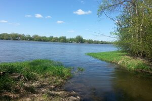
Vivian stream rises in the Special ecological planning zone (also known as ZAEP in French) of D'Auteuil woodland, at the edge of the Mille-Îles river, and displays a few tributaries from part of the Des Perrons avenue's ZAEP. It flows to the east for about 2,5 kilometers, crossing Road 335 and circumventing Auteuil's water treatment plant before flowing into the river. Buoyed by its location at the bottom of the hill of Des Terrasses avenue and Mille-Îles boulevard, it quickly drains runoff waters from a large territory mostly urbanized but also partly agricultural, so that the discharge of its water is quite variable - it may begin as an almost inexistent flow and then become a torrent in the days following heavy rains.
Some areas that are more urbanized display a narrow linearly layout, causing this fast movement of water that may induce swelling in the stream, up to more than one (1) meter of depth. A major proportion of the stream however benefits from a large free space that enables it to flood surrounding areas during snow melting episodes or long episodes of strong rain without having any impact on built environments. For example, it is the case around the water treatment plant, where we can nowadays find a very large silver maples stand frequently flooded. The stream widens also to become a big swamp, which can be easily spotted on each side of Road 335.
Auteuil woodland area is widely exploited upstream by wildlife and scattered with other wetlands with a very rich and abundant flora, which explains why it was identified as a Woodland of metropolitan interest by the Metropolitan community of Montreal and the City of Laval. Such an assignment ensures that estate development is virtually impossible and efforts are given by governments to acquire privately owned lands along Vivian stream in the heart of this woodland.